Meterological Information
Prevalent
and forecasted meteorological information along the flight route at the time of
the aircraft's position is very
important in order to avoid weather related hazards. The following diagram shows
route VCBI – EGLL, respective passing points and weather information. Weather
information are in symbolic form and their meanings are discussed accordingly.
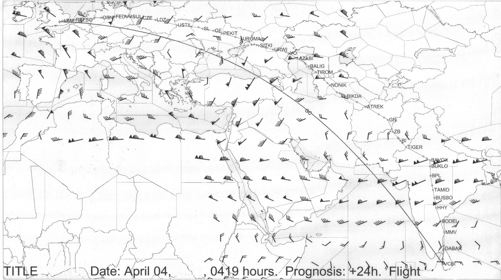
Click on the diagram for a larger view
SIGNIFICANT WEATHER USED IN FORMS
|
QUALIFIER |
WEATHER PHENOMENA |
||||
|
INTENSITY OR |
DESCRIPTOR |
PRECIPITATION |
OBSCURATION |
OTHER |
|
|
PROXIMITY |
|
|
|
|
|
|
1 |
2 |
3 |
4 |
5 |
|
|
- Light |
MI Shallow |
DZ Drizzle |
BR Mist |
PO Well |
|
|
|
|
|
|
Developed |
|
|
|
|
|
|
Dust / Sand |
|
|
|
|
|
|
Whirls |
|
|
Moderate (no |
BC Patch" |
RA Rain |
FG Fog |
|
|
|
qualifier) |
|
|
|
SQ Squalls |
|
|
|
DR Drilling |
SN Snow |
FU Smoke |
|
|
|
+ (Heavy) |
|
|
|
|
|
|
(Well developed in the case of |
|
|
|
|
|
|
Dust/sand |
|
|
|
|
|
|
whirls (dust devils) and Funnel
clouds) |
|
|
|
FC Funnel |
|
|
|
|
|
|
cloud(s) |
|
|
|
BL, Blowing |
SG Snow grains |
VA Volcanic ash |
(tornado or |
|
|
VC In the vicinity |
|
|
|
waterspout. |
|
|
|
|
IC Diamond dust |
DU Widespread |
|
|
|
|
SH Shower(s) |
|
dust |
SS Sandstorm |
|
|
|
|
PE Ice pellets |
|
|
|
|
|
|
|
|
|
|
|
|
TS Thunder- |
|
SA Sand |
DS Dust storm |
|
|
|
storm |
|
|
|
|
|
|
|
GR Hall |
|
|
|
|
|
|
|
HZ Haze |
|
|
|
|
FZ Super cooled |
|
|
|
|
|
|
|
GS Small hail |
|
|
|
|
|
|
and/or snow |
|
|
|
|
|
|
pellets |
|
|
|
Example
+
SHRA
Heavy showers of rain
-DZFG
Light drizzle and fog
NSC
No Significant Clouds
NSW
No Significant Weather
STANDARD
HEIGHTS AND TEMPERATURES OF ISOBARIC SURFACES
850
hpa
4,800 It
+ 100C
300 hPa
30,100 ft
- 32.0C
700
hPa
9,9M ft
+ 5.5.C 250
hPa
34,000 ft
- 45.0C
500
hPa
18,3M It
-4.50 C
200 hPa
38,700 ft
- 52.0C
400
hPa
23,600 ft
- 21.0C
150 hPa,
44,600 ft
- 56.5C
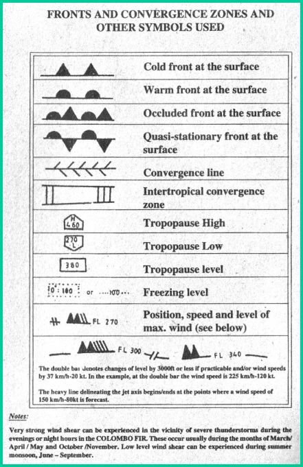
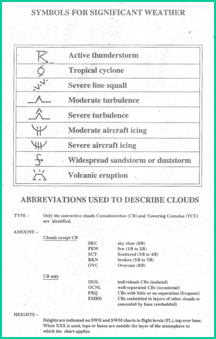
The top most figure (flight route VCBI – EGLL) is comprised some of the weather symbols exemplified by other two diagrams. This information is collected from various sources.
